Home / Quemado / Catron / Cimarron Ranch / MLS #1099430
311 Cimarron Drive
21 Photos
3d tour link
311 Cimarron Drive
311 Cimarron Drive
311 Cimarron Drive
311 Cimarron Drive
311 Cimarron Drive
311 Cimarron Drive

311 Cimarron Drive

Quemado, NM 87829

$139,900
21.42 acres
03/06/2026
Listing Date
1099430
Listing #
87829
Zip Code
Catron
County

About This Property

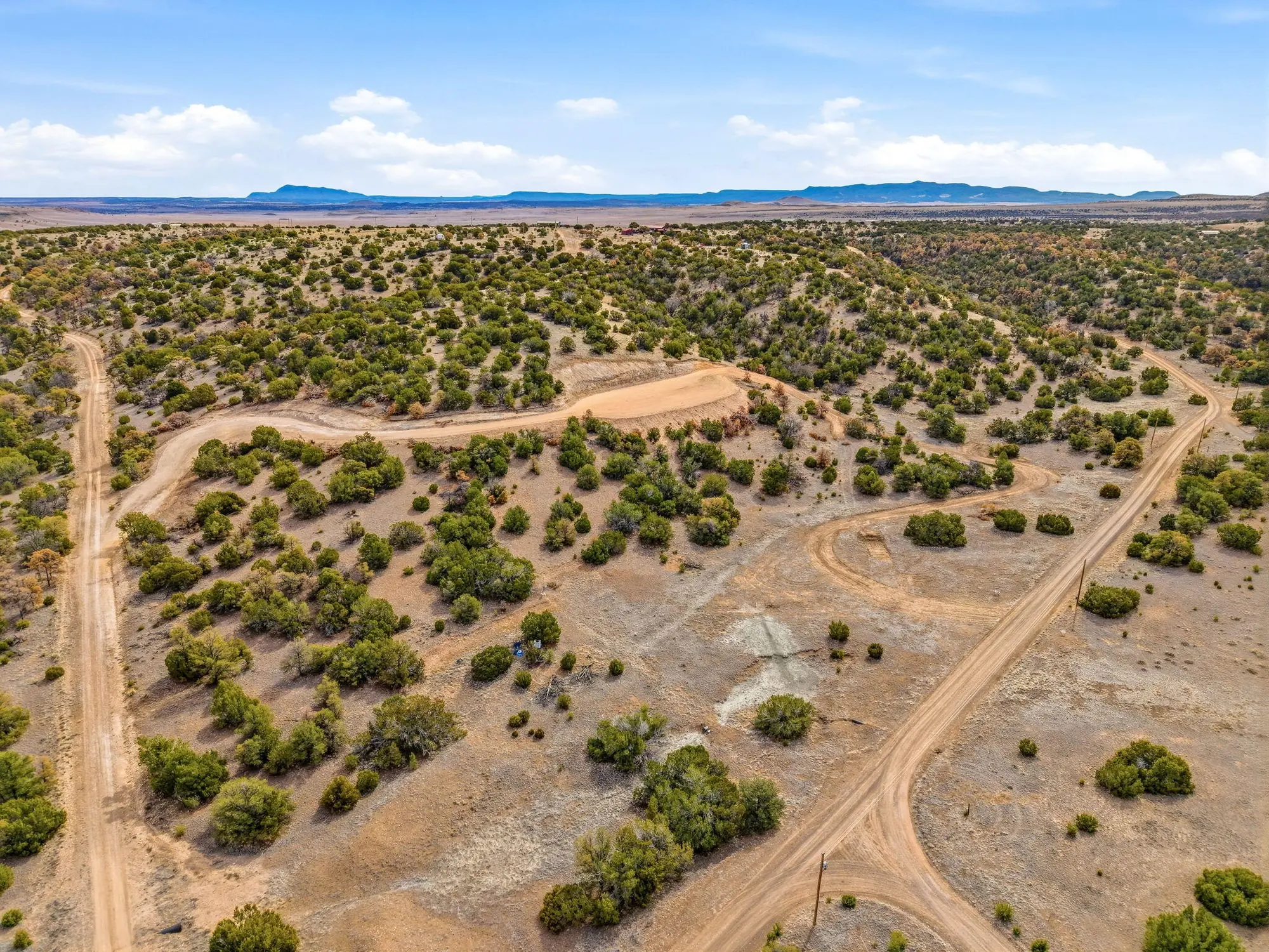
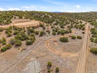
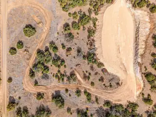
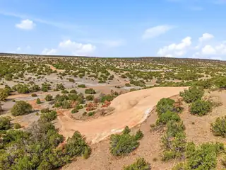
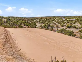
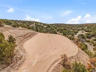
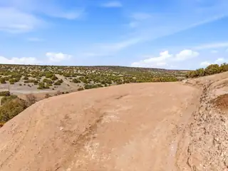
PANORAMIC VIEWS FROM THIS ONE OF A KIND 21.42 ACRE PROPERTY IN CIMARRON RANCH. 890' WELL PRODUCING 5 GPM HAS BEEN DRILLED, BUT NOT HOOKED UP. UNDERGROUND POWER TO THE PEDESTAL, BUT REQUIRES METER. HILLSIDE DRIVEWAY HAS BEEN CUT TO A HUGE COMPACTED BUILDING PAD FOR YOUR DREAM HOME WITH 200 DEGREE VIEWS. PLENTY OF LEVEL AREA BELOW FOR A WORKSHOP, BARN , HORSES, ETC. SEVERAL ROUND TOP HILLS ON THE PROPERTY ADDS TO THE SOUTHWEST LANDSCAPE. HOA COMMUNITY ($450 ANNUALLY FOR 3 LOTS) HAS MAINTAINED ROADS, SITE BUILT/MFGR HOMES, SEASONAL RVs, HORSES OK TOO. APPROX 7500' ELEVATION. 30 MINUTES TO EITHER SPRINGERVILLE, AZ OR QUEMADO, NM. LESS THAN 3 HOURS TO ALBUQUERQUE, 5 HOURS TO LAS CRUCES, TUCSON OR PHOENIX. CASH SALE ONLY.

Building And Construction

Property Type: Land

Exterior And Lot

Lot Size Acres: 21.42
Lot Size Square Feet: 933,055 sqft
View (Yes/No): Yes
Vegetation: Partially Wooded

Provisional

MLS #: 1099430
Current Use: Residential, Recreational, Unimproved
Listing Terms: Cash
Possible Use: Residential, Recreational, Unimproved

Area And Schools

Association Fee: $450 Annually
Association Fee Includes: Road Maintenance
Association Name: CIMARRON RANCH
Association (Y/N): Yes
City: Quemado
Postal Code: 87829
MLS Area Major: Catron
Subdivision: CIMARRON RANCH
County: Catron
Topography: Level, Sloping
Distance To Electric Comments: On Property
Distance To Phone Service Comments: In Street
Distance To Water Comments: On Property
Horse Amenities: Horses Allowed
Horses Allowed: Yes
Lot Features: Meadow, Views, Wooded, Acreage, Steep Slope
Number Of Lots: 3
Road Surface Type: Gravel
Parcel Number: 3116002185180

Utilities

Utilities: Cable Not Available, Electricity Available, Natural Gas Not Available, Phone Available, Underground Utilities, Water Available, Sewer Not Available
Water Source: Private, Well

Location

Loading map...

Directions: WEST OF QUEMADO, NM & EAST OF SPRINGERVILLE, AZ ON US HWY 60 - APPROX NEW MEXICO MILE MARKER 10.5 (RED HILL) TAKE HEAP RANCH ROAD NORTH 8/10 MILE PAST FIRE STATION AND TURN LEFT ON CIMARRON RANCH DRIVE. TRAVEL 7/10 MILE TO MUSTANG TRAIL AND TURN RIGHT, TRAVEL 2/10 MILE AND VEER LEFT ON TO PINION HEIGHTS. TRAVEL 5/10 OF A MILE TO THE PROPERTY ON BOTH THE RIGHT AND LEFT SIDE OF THE ROAD - SIGNS

Mortgage Calculator

$
$
%
Monthly Payment**:
** All calculations are estimates and provided for informational purposes only. Actual amounts may vary.
Listing courtesy of New Mexico Land & Investments
Southwest MLS Logo Some of the information contained herein has been provided by SWMLS, Inc. This information is from sources deemed reliable but not guaranteed by SWMLS, Inc. The information is for consumers’ personal, non-commerical use and may not be used for any purpose other than identifying properties which consumers may be interested in purchasing.
Daria Derebera Realtor

Daria Derebera

Real Estate Broker in Albuquerque, NM