Home / Quemado / Catron / Cimarron Ranch / MLS #1099394
196 Cimarron Drive
32 Photos
3d tour link
196 Cimarron Drive
196 Cimarron Drive
196 Cimarron Drive
196 Cimarron Drive
196 Cimarron Drive
196 Cimarron Drive

196 Cimarron Drive

Quemado, NM 87829

$340,000
58.54 acres
03/06/2026
Listing Date
1099394
Listing #
87829
Zip Code
Catron
County

About This Property

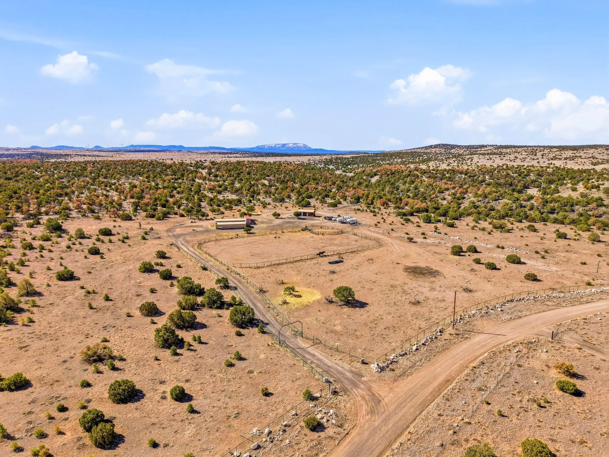
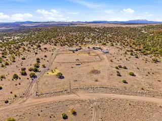
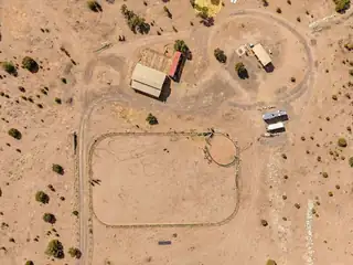
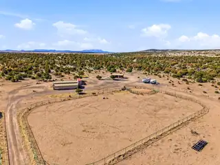
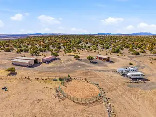
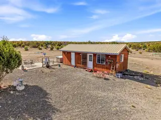
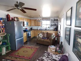
HORSE RANCH - 58.54 FENCED ACRES ADJACENT TO BLM TO THE NORTH. BUNKHOUSE WITH KITCHEN, 4 STALL HORSE BARN WITH RUNS, COULD BE CONVERTED TO 8 STALL. HUGE 250' X 150' FENCED ARENA. (2) RV HOOKUPS WITH 50 AMP SERVICE, WATER & SEPTIC. DOMESTIC WELL 10 GPM WITH SEVERAL FROST FREE SPIGOTS, POWER TO TO ALL BUILDINGS AND RV'S, PERMITTED SEPTIC SYSTEM. THE PROPERTY IS APPROXIMATELY 7500' ELEVATION WITH VIEWS IN ALL DIRECTIONS. A PRIVATE RETREAT ON A MAINTAINED GRAVEL ROAD. CIMARRON RANCH IS A HOA COMMUNTY, ANNUAL DUES ARE $750 FOR ALL 5 PARCELS. APACHE NATIONAL FOREST AND GILA NATIONAL FOREST ARE NEARBY WITH EXCEPTIONAL HORSEBACK RIDING, HIKING & ELK HUNTING. 30 MINUTES TO SPRINGERVILLE, AZ OR QUEMADO, NM. APPROX 3 HOURS TO ALBUQUERQUE, 5 HOURS TO LAS CRUCES, PHOENIX OR TUCSON. CASH SALE ONLY.

Building And Construction

Property Type: Land

Exterior And Lot

Lot Size Acres: 58.54
Lot Size Square Feet: 2,550,002 sqft
Exterior Features: Propane Tank - Leased
View (Yes/No): Yes
Vegetation: Partially Wooded

Provisional

MLS #: 1099394
Current Use: Residential, Recreational, Unimproved
Listing Terms: Cash
Possible Use: Residential, Recreational, Unimproved

Area And Schools

Association Fee: $750 Annually
Association Fee Includes: Road Maintenance
Association Name: CIMARRON RANCH
Association (Y/N): Yes
City: Quemado
Postal Code: 87829
MLS Area Major: Catron
Subdivision: CIMARRON RANCH
County: Catron
Topography: Level
Distance To Electric Comments: On Property
Distance To Phone Service Comments: In Street
Distance To Water Comments: On Property
Horse Amenities: Horses Allowed
Horses Allowed: Yes
Lot Features: Other, Split Possible, See Remarks, Views, Wooded, Acreage, Stream/Creek
Number Of Lots: 5
Other Structures: Outbuilding
Road Surface Type: Graded
Parcel Number: 3116002341500

Utilities

Utilities: Cable Not Available, Electricity Connected, Natural Gas Not Available, Propane, Phone Available, Sewer Not Available, Water Connected
Water Source: Private, Well
Sewer: Septic Tank

Location

Loading map...

Directions: WEST OF QUEMADO, NM & EAST OF SPRINGERVILLE, AZ ON US HWY 60. NEW MEXXICO MILE MARKER APPROX 10.5 (RED HILL). TAKE HEAP RANCH ROAD APPROX 8/10 MILE PAST FIRE STATION AND TURN LEFT ON CIMARRON RANCH DRIVE. STAY ON THIS ROAD FOR APPROX 2 MILES TO PROPERTY ON THE LEFT. GATED & OCCUPIED. SIGN

Mortgage Calculator

$
$
%
Monthly Payment**:
** All calculations are estimates and provided for informational purposes only. Actual amounts may vary.
Listing courtesy of New Mexico Land & Investments
Southwest MLS Logo Some of the information contained herein has been provided by SWMLS, Inc. This information is from sources deemed reliable but not guaranteed by SWMLS, Inc. The information is for consumers’ personal, non-commerical use and may not be used for any purpose other than identifying properties which consumers may be interested in purchasing.
Daria Derebera Realtor

Daria Derebera

Real Estate Broker in Albuquerque, NM